Technical Blog Post
Abstract
ITNM 4.2 changing the config.json for making use of an online mapping provider for ncp_gis geographical discovery
Body
In contrast to a previous blog entry about changing the config.json file to point to an offline map, this entry will give some simple examples of online maps easily available with ITNM 4.2 fp3.
Blog instructions for offline WMS map and config.json configuration
The config.json is located in the 'jazz' path
/opt
Changes to the config.json are immediately picked for the GUI. I prefer to logout and clear the browser cache when I make mapping provider changes.
I'll be working with my same topology which are two routers with connectivity in Florida.
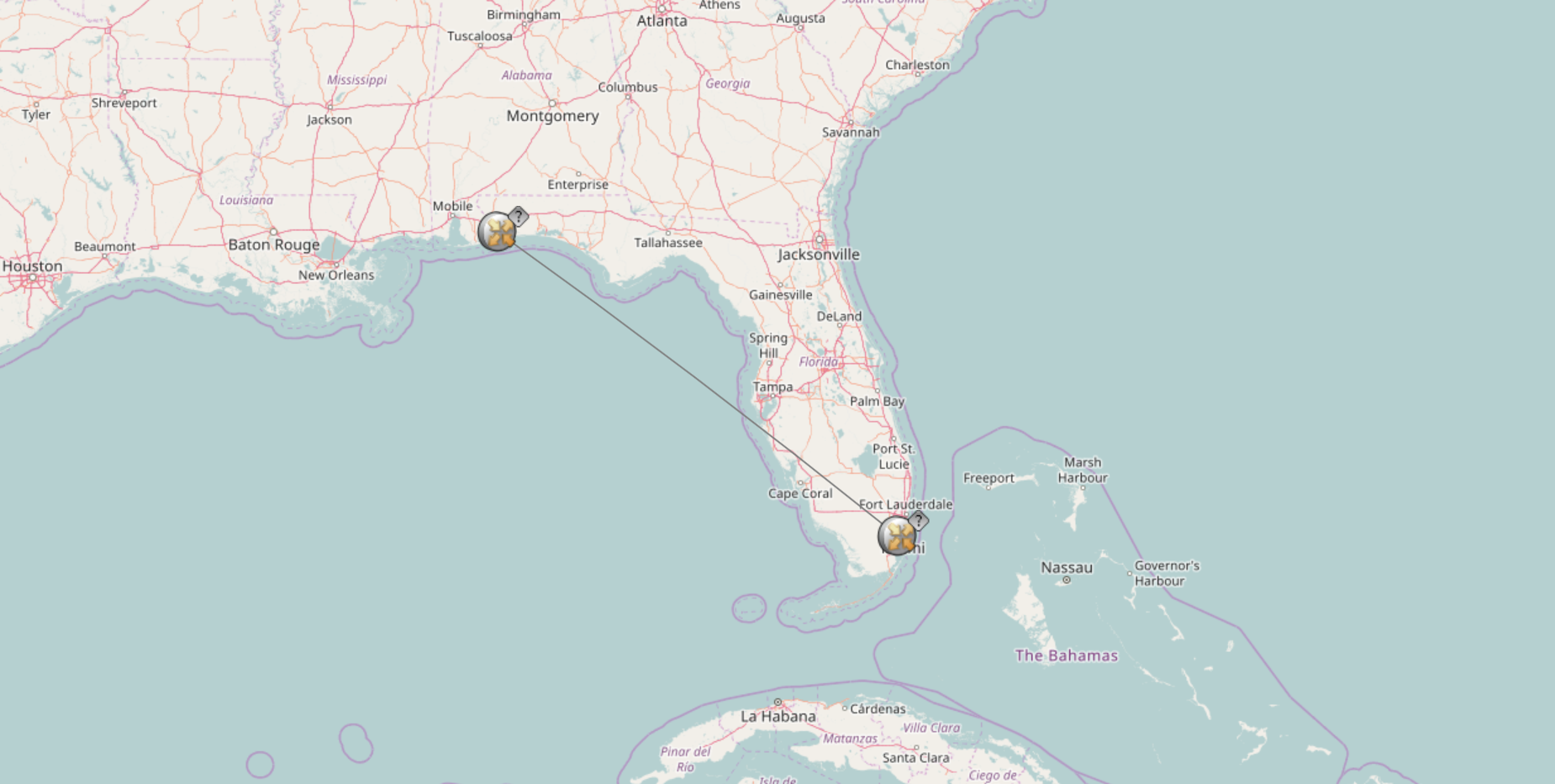
This is the default 'OSM' map when geographical mapping is configured correctly and a default config.json is used.
"mapProvider": {
"baseMapLayerName": "IBM Network Management",
"baseLayer": "osm",
"baseLayersDefn": {
"osm": {
"baseLayerName": "Test OpenStreetMap"
},
The base layer in the config.json file is defined as 'osm'
Let's take a look at what happens when 'google' is enabled. Making only this one change
"baseMapLayerName": "IBM Network Management",
"baseLayer": "google",
I log out and clear my cache.

Take note of the 'deprecated' maps popup message when using ITNM 4.2 fp3 and the recommendation to switch back to 'osm'.
Next I change the
"baseMapLayerName": "IBM Network Management",
"baseLayer": "xyz",
With this map service
"urls": ["https://server.arcgisonline.com/ArcGIS/rest/services/World_Topo_Map/Map…{z}/{y}/{x}"]

Within the gallery of arcgis there are other sample online maps to utilize
http://www.arcgis.com/home/gallery.html#c=esri&t=maps&o=modified
Here is a more plain look created by just changing that url
"urls": ["https://server.arcgisonline.com/ArcGIS/rest/services/canvas/World_Light…{z}/{y}/{x}"]

And one more
"urls": ["https://server.arcgisonline.com/ArcGIS/rest/services/NatGeo_World_Map/M…{z}/{y}/{x}"]

Remember you can have only one url active in your config.json for any baselayerDefn.

Subscribe and follow us for all the latest information directly on your social feeds:
|
|
 |

|
| Check out all our other posts and updates: | |
| Academy Blogs: | https://goo.gl/eZjStB |
| Academy Videos: | https://goo.gl/kJeFZE |
| Academy Google+: | https://goo.gl/HnTs0w |
| Academy Twitter : | https://goo.gl/DiJbvD |

UID
ibm11082463